Notes for the journey
Lake Titicaca map: islands, bases and border
A useful Titicaca map separates geographic position from the service you can actually book. Drawn connections help plan a route; they do not establish a direct boat at every hour.
Compare tours: Lake Titicaca tours: La Paz & Copacabana [2026] →
Updated
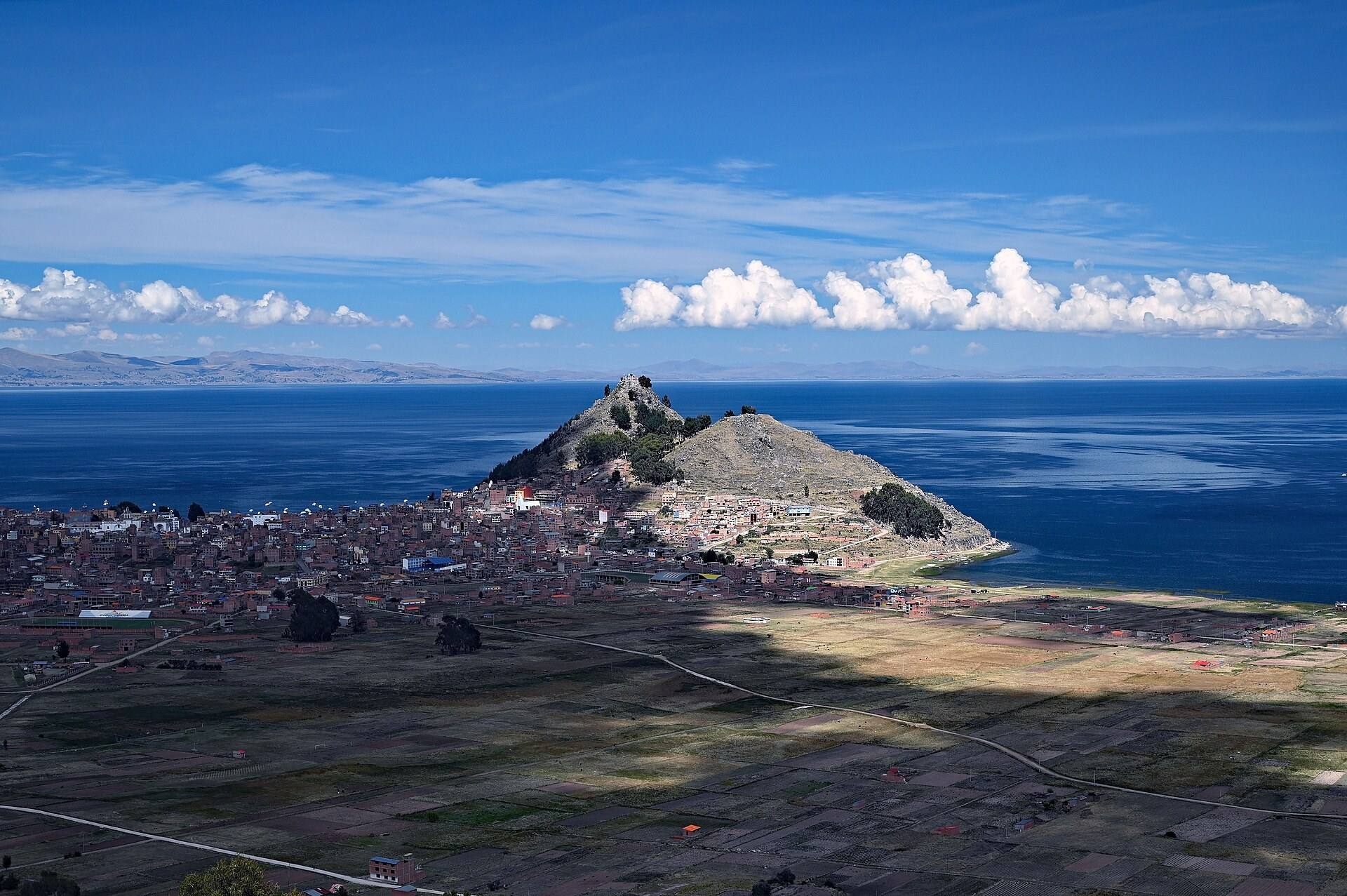
The short answer
Choose your base and island sector before buying a ticket. Points are approximate and unsuitable for navigation or identifying an exact dock.
TITICACA
A map for planning the journey
Select a stop to see its role in the trip. Lines show planning connections, not live services, road directions or guaranteed transfers. Confirm departures and access with your operator.
Number labels are offset where needed; fine lines connect them to the actual point.
La Paz
Road departure base: confirm your hotel or terminal.
-16.4950°, -68.1340° · Open geographical map ↗
Tiquina
Strait crossing, separate from the Sun Island boat.
-16.2180°, -68.8550° · Open geographical map ↗
Copacabana
Bolivian base: bay, basilica and island departures.
-16.1660°, -69.0850° · Open geographical map ↗
Yumani · Isla del Sol sur
Southern sector; check landing and uphill accommodation access.
-16.0370°, -69.1450° · Open geographical map ↗
Challapampa · Isla del Sol norte
Northern sector; confirm path access locally.
-15.9900°, -69.1760° · Open geographical map ↗
Isla de la Luna
Archaeological visit only on an option that includes it.
-16.0390°, -69.0720° · Open geographical map ↗
Kasani · Perú / Bolivia
International crossing: documents and immigration processing.
-16.2190°, -69.0960° · Open geographical map ↗
Puno · Perú
Peruvian base; visiting Copacabana crosses a border.
-15.8400°, -70.0210° · Open geographical map ↗
- La Paz → Tiquina · Road: Road itinerary segment; timetable not verified.
- Tiquina → Copacabana · Guided excursion: Continuation including Tiquina crossing according to booked service.
- Copacabana → Yumani · Isla del Sol sur · Guided excursion: For a service visiting the south; not a published frequency.
- Copacabana → Challapampa · Isla del Sol norte · Guided excursion: Confirm a northern option, landing and return.
- Copacabana → Isla de la Luna · Guided excursion: Connection on an excursion including Moon Island; may call at Sun Island.
- Puno · Perú → Kasani · Perú / Bolivia · Road: Observed commercial route via Kasani; verify documents.
- Kasani · Perú / Bolivia → Copacabana · Road: After immigration processing; entry is not guaranteed.
Select a stop to see its role in the trip. Lines show planning connections, not live services, road directions or guaranteed transfers. Confirm departures and access with your operator. · Natural Earth
The structure of the lake
ALT distinguishes the main lake, Puno Bay and the smaller Huiñaymarca basin, connected through Tiquina. Shared water does not remove land borders. This map highlights the visitor bases relevant to the guide rather than every settlement or channel. Screen distance also does not establish sailing time, which depends on vessel, route and conditions.
Read the Bolivian side
La Paz connects by road and Tiquina to Copacabana. Lake itineraries may then visit southern Yumani, the northern Challapampa sector or Moon Island. Not every boat joins them in one excursion. A line between ports does not confirm a through-walk between communities; ask locally about path access.
Puno and the Kasani crossing
Puno is a Peruvian base. Researched Copacabana products can use Kasani and offer Puno return or La Paz finish by option. The international segment requires its own documentation. The map does not recommend bypassing controls or using unauthorized paths; it shows journey planning rather than border-driving instructions.
What to confirm after using the map
Record the operator, exact meeting point, port, one-way or return terms and final return of your service. Ask about luggage and free time. No single public timetable or all-island combined tariff was verified. Use the map to ask questions rather than invent an unsupported connection. Leave time if your next journey depends on boat arrival.
Three route chains to read on the map
For a first visit from La Paz, read the sequence as La Paz → Tiquina → Copacabana → a selected island landing. Tiquina is a crossing within Bolivia; it is not the Peru border and should not be confused with a change of country. The island boat comes later, after the road journey has reached Copacabana.
For a crossing from Puno, read Puno → Kasani → Copacabana. Decide whether your service returns to Puno or continues toward La Paz after the visit. For an island overnight, think in two separate legs: Copacabana to the correct arrival port, then the confirmed departure port back to the mainland. None of these chains determines the actual boarding point or validates a same-day connection.
Use the points to make a booking checklist
Yumani marks the southern sector; Challapampa marks the northern sector. The separation explains why a south-only visit should not be sold in your mind as a complete island circuit. Moon Island is another stop across water. A route naming it needs a boat plan of its own or an explicitly combined product.
Before reserving, pair each line with the name of the service and each stop with the time available ashore. Download your confirmation and exact meeting instructions for offline use. If the operator changes a landing, reconfirm the route to your accommodation and return rather than following an approximate map pin.
- Tiquina: Bolivian road-and-water crossing, not immigration.
- Kasani: international paperwork, not an island pier.
- Yumani and Challapampa: different island sectors.
- Moon Island: confirm a specific boat stop.
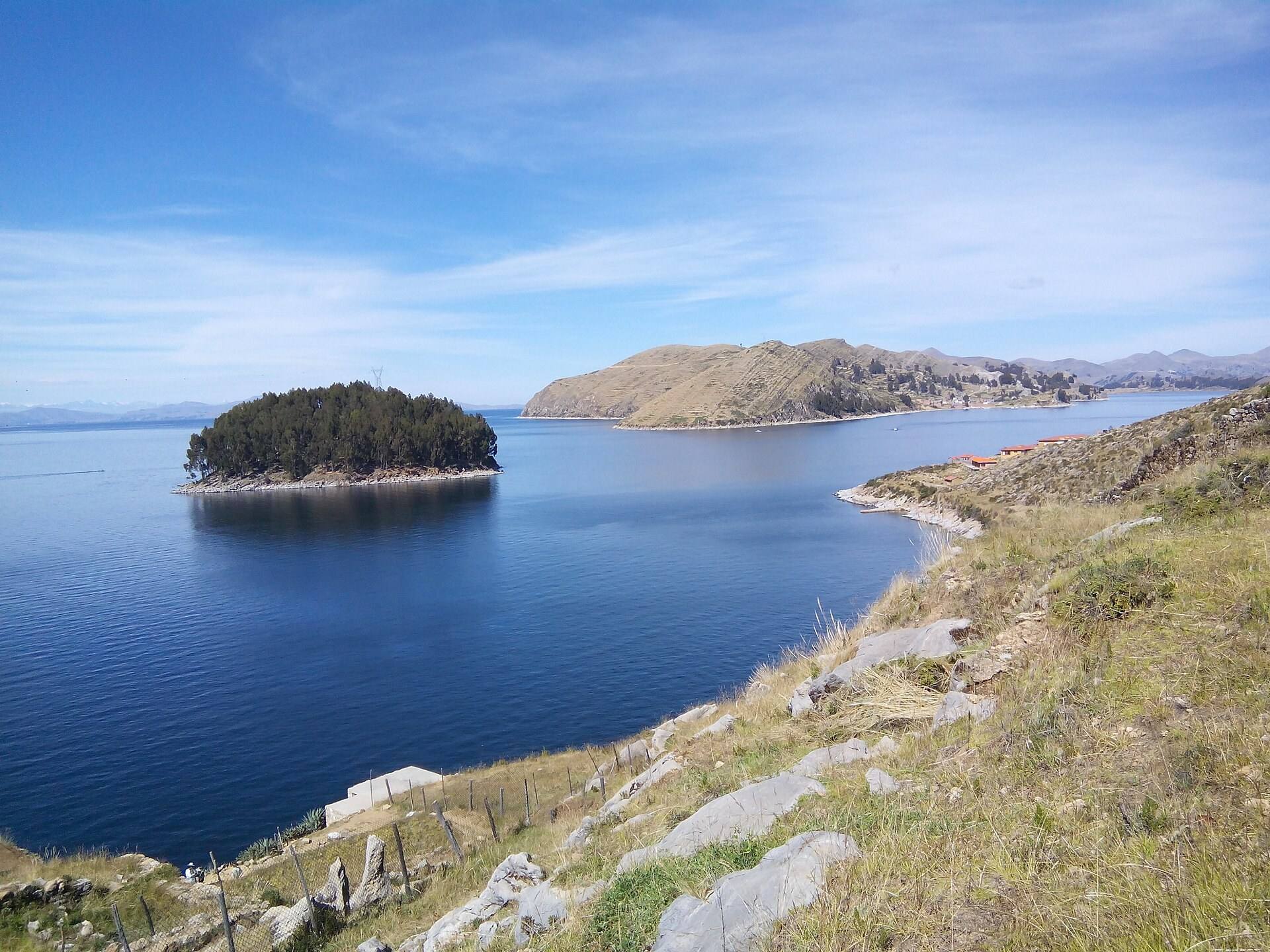
Blue water and a small wooded shore beside Isla del Sol.
Sources & last checked
Checked 20 October 2026. Prices, access and transport can change; confirm with the linked official source before travelling.
Plan your trip
Compare tours
Check current dates, inclusions and availability on GetYourGuide.
We may earn a commission on bookings through these links. How this works.